Well This is Not Needed
Posted by Dennis on Nov 6, 2012 in Winter Weather | 0 comments
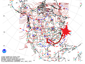
Typically, I would be excited to see a low deepen rapidly off the DelMarVa coast, it typically brings me a good chance of at least a moderate snow storm. This is not the case this week. Below is a quick description of the current set up, followed by a forecast.
Current Conditions
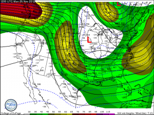
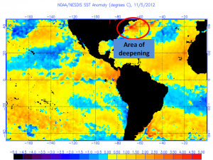
Much like last week with Sandy, there is a strong jet streak diving through the central US with the associated low on the left exit region of the streak. Also much like with Sandy, there is a large area of anomalously warm water off the Mid-Atlantic and Northeast coast. These are important details that will come into play as the storm begins to strengthen on Tuesday evening. Temperatures in the Northeast have been well below normal since Sandy left the region.
NAO is again quite negative which will allow anything that does form off the coast to remain close enough to have some form of impact on the heavily populated region. As is usually the case, when there is a deepening trough in the eastern half of the country an equally as high amplitude ridge forms on the other half of the country. Los Angeles set a record high today reaching 91 degrees at the airport.
Forecast
Forecasting this storm is actually much more difficult than the forecast for Sandy. Coastal winter storms bring with them the difficulty of forecasting the location of the rain/snow/mix line, a difference of 75 miles makes a drastic difference in snow amounts. Another curve ball being thrown is the climatology of early November, it is rare to get heavy measurable snow in this part of the country (East of the Appalachians). What can be said for sure is that a deepening low pressure system will form and bring with it strong winds from the east and then northeast which will push water up an already damaged shoreline.
Given climatology and the potential of this storm, I anticipate many areas to see snowfall in the 1-3 range. If the storm were to take a more westerly track, parts of the Pocono’s could see 3-6 inches of snowfall while the major cities will remain warm enough for rain to fall. Of far greater concern is the winds that will accompany the storm as it deepens on the coast; coastal locations will see winds gusting above 40 mph and sustained in the 25-35 mph range. It is these winds which will again push water towards the coast and bring with it moderate to potentially severe coastal flooding along the New Jersey coast.

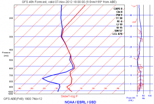
Forecast sounding for Allentown, PA. Shows that most of the column is below freezing and supportive of snow.
Potential Impacts
- Strong gusty winds at the coast (>40 mph); decreasing the further you go inland.
- Snowfall 1″-3″ over a large area; It is not anticipated to be a large impact on travel (heavily dependent on time of day)
- Moderate to severe coastal flooding; especially in areas already hard hit by Sandy
- Areas of power outages due to the gusty winds and weakened trees
I will issue a snowfall map tomorrow as we’ll have a MUCH better idea of the position of the low.
Please feel free to ask any questions in the comment section; all posts on this site will be discussions.


